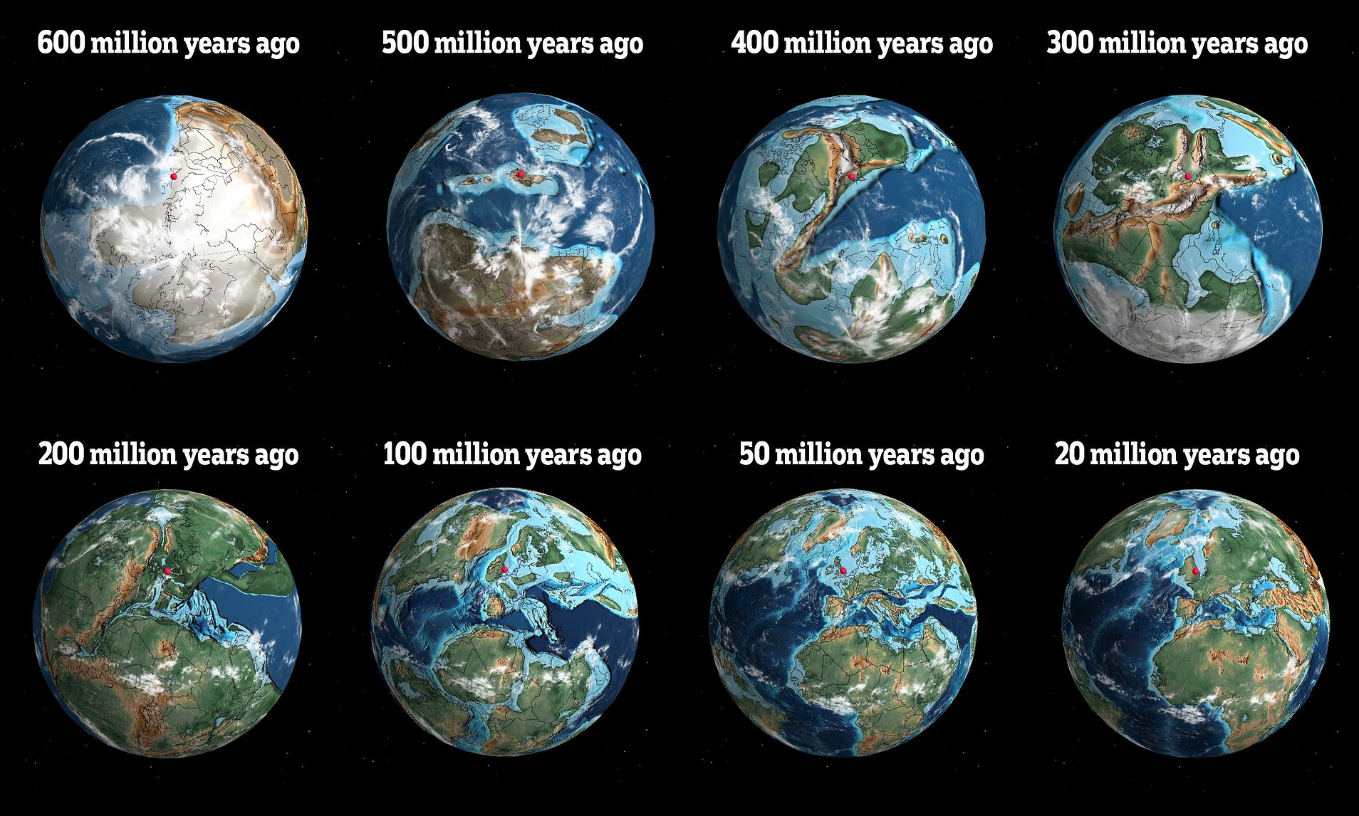
- A digital globe makes it possible to see where your hometown would have been 750 million years ago.
- Scientist Ian Webster was the brains behind the digital globe.
- The globe shows how much change Earth has experienced over hundreds of millions of years.
300 million years ago the world consisted of just one single continent: Pangaea — 200 to 150 million years ago it started to split into two parts: Laurasia and Gondwana.
With time and a very slow shifting of our tectonic plates, our planet morphed into what it is today.
A digital globe rendering of the Ancient Earth makes it possible to see where your hometown would have been 750 million years ago — 150 million years before the first multi-cellular life forms developed.
Using data from a software platform called G-Plates, scientist Ian Webster created a digital globe where you can see where and when you would have lived at various points in Earth’s history.
The map consists of 91 paleogeographic maps spanning the Phanerozoic and late Neoproterozoic periods, illustrating the ancient configuration of the ocean basins and continents, as well as important features including mountains, shallow sea, and deep oceans.
We searched where New York City would have been at different stages throughout history — the pale pink marker shows where New York City would have been.
Around 400 million years ago, the first vertebrates began walking on land. The Earth’s landscape looked very different to how it does now.
When the first dinosaurs began roaming Earth 220 million years ago, New York City was far closer to Morocco than it is today.
While the continents of North America and South America may look a lot more familiar than the previous landscapes, hominids were only just starting to appear at this stage.
Researchers have suggested that the Earth’s plates will eventually meld into a “supercontinent” in roughly 300 million years, which they’ve dubbed Amasia.


